
Woods Cross topographic map
Interactive map
Click on the map to display elevation.
About this map
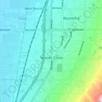
Name: Woods Cross topographic map, elevation, terrain.
Location: Woods Cross, Davis County, Utah, 84087, United States (40.86150 -111.94915 40.88781 -111.88834)
Average elevation: 1,352 m
Minimum elevation: 1,285 m
Maximum elevation: 1,701 m
Other topographic maps
Click on a map to view its topography, its elevation and its terrain.
Layton
United States > Utah > Davis County > Layton
Layton, Davis County, Utah, United States
Average elevation: 1,373 m