Geolocate

Stamford topographic map

Click on the map to display elevation.

About this map
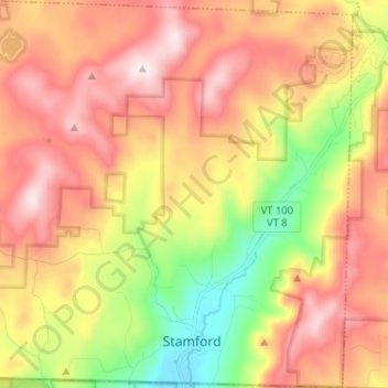
Name: Stamford topographic map, elevation, terrain.

Location: Stamford, Bennington County, Vermont, 05352, United States (42.74104 -73.14267 42.83559 -73.01517)

Average elevation: 646 m

Minimum elevation: 325 m

Maximum elevation: 935 m

Other topographic maps

Click on a map to view its topography, its elevation and its terrain.

North Pownal

United States > Vermont > Bennington County

Average elevation: 254 m

South Dorset

United States > Vermont > Bennington County

Average elevation: 377 m

Bondville

United States > Vermont > Bennington County > Winhall

Average elevation: 486 m

Bondville

United States > Vermont > Bennington County > Winhall

Average elevation: 486 m

South Dorset

United States > Vermont > Bennington County

Average elevation: 377 m

Gear up for your next adventure:

🥾Waterproof Hiking Boots - Boots keeping your feet dry in wet conditions
💧Reusable Water Bottle - Durable water bottles for hydration on trails
🥤Collapsible Travel Cup - Saves space and weight in your mess kit
🧢Sun Protection Cap - Breathable cap to protect from sun exposure
🥾Mountain Hiking Boots - High-traction boots for rocky terrain

As an Amazon Associate, this site earns from qualifying purchases at no extra cost to you.