
东城乡 topographic map
Interactive map
Click on the map to display elevation.
About this map
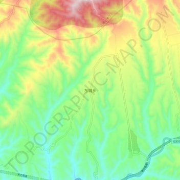
Name: 东城乡 topographic map, elevation, terrain.
Location: 东城乡, 吉县, 临汾市, 山西省, 中国 (36.04922 110.53430 36.12922 110.61430)
Average elevation: 914 m
Minimum elevation: 677 m
Maximum elevation: 1,323 m
Other topographic maps
Click on a map to view its topography, its elevation and its terrain.