Geolocate

Hector Tejada topographic map

Click on the map to display elevation.

About this map

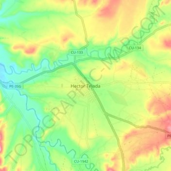
Name: Hector Tejada topographic map, elevation, terrain.

Location: Hector Tejada, Pallpata, Espinar, Cusco, Perú (-14.93058 -71.24970 -14.85058 -71.16970)

Average elevation: 3,990 m

Minimum elevation: 3,925 m

Maximum elevation: 4,074 m

Gear up for your next adventure:

🔭Compact Monocular - One-handed bird watching and trail spotting
🥾Hiking Shorts - Breathable shorts suitable for summer hikes
🧼Travel Hand Sanitizer - Keep hands clean when water is scarce
🧴Sunscreen SPF - Broad-spectrum sunscreen for outdoor activities
Camping Coffee Maker - Brew fresh coffee anywhere on the topographic map

As an Amazon Associate, this site earns from qualifying purchases at no extra cost to you.