Geolocate

Patro topographic map

Click on the map to display elevation.

About this map

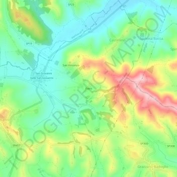
Name: Patro topographic map, elevation, terrain.

Location: Patro, Castellino, Moncalvo, Asti, Piemonte, 14035, Italia (45.03721 8.27303 45.07721 8.31303)

Average elevation: 241 m

Minimum elevation: 157 m

Maximum elevation: 390 m

Gear up for your next adventure:

🎒Hiking Backpack - Lightweight and ergonomic backpacks for day hikes or multi-day treks
🥾Lightweight Hiking Shoes - Comfortable shoes for day hikes
🥾Mountaineering Boots - Supportive boots for climbing and high-altitude hiking
🥫Freeze-Dried Meals - Lightweight, high-calorie nutrition for multi-day treks
Camping Essentials - All-in-one gear for a comfortable camping trip

As an Amazon Associate, this site earns from qualifying purchases at no extra cost to you.