
垣曲县 topographic map
Interactive map
Click on the map to display elevation.
About this map
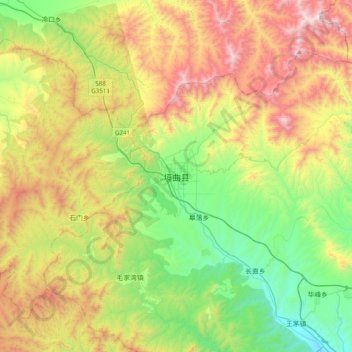
Name: 垣曲县 topographic map, elevation, terrain.
Location: 垣曲县, 运城市, 山西省, 中国 (35.13564 111.49488 35.45564 111.81488)
Average elevation: 858 m
Minimum elevation: 278 m
Maximum elevation: 1,783 m