
Thank you for supporting this site ❤️
Make a donation
Make a donation
Gear up for your next adventure:
As an Amazon Associate, this site earns from qualifying purchases at no extra cost to you.
Jabal al-Dakrour topographic map
Click on the map to display elevation.
Thank you for supporting this site ❤️
Make a donation
Make a donation
Gear up for your next adventure:
As an Amazon Associate, this site earns from qualifying purchases at no extra cost to you.
About this map
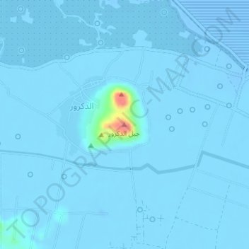
Name: Jabal al-Dakrour topographic map, elevation, terrain.
Location: Jabal al-Dakrour, الدكرور, Matruh, 51714, Egypt (29.18763 25.55330 29.18773 25.55340)
Average elevation: -7 m
Minimum elevation: -19 m
Maximum elevation: 83 m
Thank you for supporting this site ❤️
Make a donation
Make a donation
Gear up for your next adventure:
As an Amazon Associate, this site earns from qualifying purchases at no extra cost to you.