Geolocate

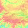
Needmore topographic map

Click on the map to display elevation.

About this map

Name: Needmore topographic map, elevation, terrain.

Location: Needmore, Montgomery County, Middle Tennessee, Tennessee, 37191, United States (36.44616 -87.59863 36.48616 -87.55863)

Average elevation: 170 m

Minimum elevation: 117 m

Maximum elevation: 219 m

Other topographic maps

Click on a map to view its topography, its elevation and its terrain.

Lake Taal

United States > Tennessee > Montgomery County

Average elevation: 165 m

Gear up for your next adventure:

🧢Beanie Hat - Keep your head warm in cold weather
🛶Canoe Life Vest - Safety vest for water sports
🔭Compact Binoculars - Lightweight optics for scouting trails and wildlife
🧴Bear Spray Holster - Quick-access carry for essential Canadian wilderness safety
🚲Handlebar Phone Mount - View topographic-map.com live while cycling

As an Amazon Associate, this site earns from qualifying purchases at no extra cost to you.