
Monistrol-sur-Loire topographic map
Interactive map
Click on the map to display elevation.
About this map
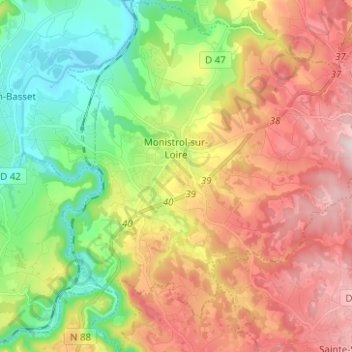
Name: Monistrol-sur-Loire topographic map, elevation, terrain.
Average elevation: 629 m
Minimum elevation: 432 m
Maximum elevation: 868 m
Other topographic maps
Click on a map to view its topography, its elevation and its terrain.
Vals-près-le-Puy
França > Auvergne-Rhône-Alpes > Haute-Loire
Vals-près-le-Puy, Le Puy-en-Velay, Haute-Loire, Auvergne-Rhône-Alpes, França metropolitana, 43750, França
Average elevation: 759 m
Allègre
França > Auvergne-Rhône-Alpes > Haute-Loire
Allègre, Le Puy-en-Velay, Haute-Loire, Auvergne-Rhône-Alpes, França metropolitana, 43270, França
Average elevation: 966 m