
Thank you for supporting this site ❤️
Make a donation
Make a donation
Gear up for your next adventure:
As an Amazon Associate, this site earns from qualifying purchases at no extra cost to you.
Ruhpolding topographic map
Click on the map to display elevation.
Thank you for supporting this site ❤️
Make a donation
Make a donation
Gear up for your next adventure:
As an Amazon Associate, this site earns from qualifying purchases at no extra cost to you.
About this map
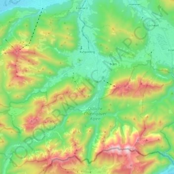
Name: Ruhpolding topographic map, elevation, terrain.
Location: Ruhpolding, Landkreis Traunstein, Bavaria, 83324, Germany (47.67012 12.51204 47.79567 12.72504)
Average elevation: 988 m
Minimum elevation: 521 m
Maximum elevation: 1,927 m
Thank you for supporting this site ❤️
Make a donation
Make a donation
Gear up for your next adventure:
As an Amazon Associate, this site earns from qualifying purchases at no extra cost to you.