Geolocate

Cuijk topographic map

Click on the map to display elevation.

About this map

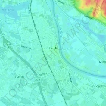
Name: Cuijk topographic map, elevation, terrain.

Location: Cuijk, Land van Cuijk, North Brabant, Netherlands (51.70557 5.84158 51.74987 5.89760)

Average elevation: 13 m

Minimum elevation: 5 m

Maximum elevation: 59 m

Other topographic maps

Click on a map to view its topography, its elevation and its terrain.

Startwijk

Netherlands > North Brabant > Beugen

Average elevation: 13 m

Gear up for your next adventure:

🛏️Camping Sleeping Mat - Comfortable mats for sleeping outdoors
👟Leg Gaiters - Keep debris, mud, and snow out of your boots
🥫Freeze-Dried Meals - Lightweight, high-calorie nutrition for multi-day treks
🧴First Aid Kit - Essential first aid supplies for outdoor emergencies
🛶Canoe Life Vest - Safety vest for water sports

As an Amazon Associate, this site earns from qualifying purchases at no extra cost to you.