Geolocate

Rubió topographic map

Click on the map to display elevation.

About this map

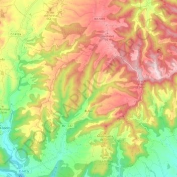
Name: Rubió topographic map, elevation, terrain.

Location: Rubió, Anoia, Barcelona, Catalonia, Spain (41.61335 1.53720 41.69590 1.63465)

Average elevation: 607 m

Minimum elevation: 381 m

Maximum elevation: 832 m

Other topographic maps

Click on a map to view its topography, its elevation and its terrain.

Rofes

Spain > Catalonia > Anoia > la Llacuna

Average elevation: 595 m

Gear up for your next adventure:

🔨Vehicle Emergency Tool - Safety tool for remote road trips to trailheads
Family Camping Tent - Spacious tent suitable for family camping trips
🧰Survival Kit - Essential gear for emergencies in the wilderness
❄️Traction Ice Cleats - Slip-on spikes for icy trails and winter hiking
🧢Outdoor Cap - Protective cap for sun and rain during hikes

As an Amazon Associate, this site earns from qualifying purchases at no extra cost to you.