
Parseierspitze topographic map
Interactive map
Click on the map to display elevation.
About this map
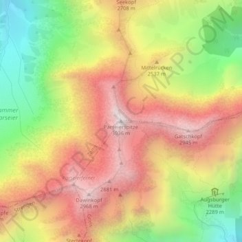
Name: Parseierspitze topographic map, elevation, terrain.
Average elevation: 2,414 m
Minimum elevation: 1,737 m
Maximum elevation: 3,009 m
La Parseierspitze est un sommet des Alpes, à 3 036 m d'altitude, point culminant des Alpes de Lechtal, en Autriche (land du Tyrol).