Geolocate

Attabira topographic map

Click on the map to display elevation.

About this map

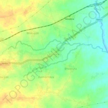
Name: Attabira topographic map, elevation, terrain.

Location: Attabira, Bargarh District, Odisha, 768027, India (21.35388 83.76671 21.39388 83.80671)

Average elevation: 162 m

Minimum elevation: 146 m

Maximum elevation: 175 m

Gear up for your next adventure:

🛰️Satellite Messenger - Emergency communication for areas with no cell service
🧭GPS Handheld Device - Reliable GPS navigation for outdoor adventures
🦶Hiking Shoe Insoles - Added support for high arches and long days on feet
🥾Mountain Hiking Boots - High-traction boots for rocky terrain
🛶Canoe Life Vest - Safety vest for water sports

As an Amazon Associate, this site earns from qualifying purchases at no extra cost to you.