Geolocate

Kesses topographic map

Click on the map to display elevation.

About this map

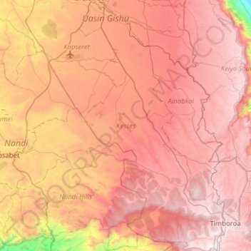
Name: Kesses topographic map, elevation, terrain.

Location: Kesses, Uasin Gishu County, Rift Valley, Kenya (0.00649 35.25021 0.51279 35.54712)

Average elevation: 2,224 m

Minimum elevation: 1,174 m

Maximum elevation: 2,894 m

Gear up for your next adventure:

🧢Hiking Sun Hat - Wide-brimmed protection for exposed mountain ridges
🔥Emergency Fire Starter - Reliable ignition source for all weather conditions
🥾Durable Hiking Shoes - Long-lasting shoes for frequent hiking
💧Hydration Bladder - Hands-free hydration solution for long treks
🏃Hydration Running Vest - Carry water and maps close to your body for speed

As an Amazon Associate, this site earns from qualifying purchases at no extra cost to you.