
Thank you for supporting this site ❤️
Make a donation
Make a donation
Gear up for your next adventure:
As an Amazon Associate, this site earns from qualifying purchases at no extra cost to you.
Peeploon topographic map
Click on the map to display elevation.
Thank you for supporting this site ❤️
Make a donation
Make a donation
Gear up for your next adventure:
As an Amazon Associate, this site earns from qualifying purchases at no extra cost to you.
About this map
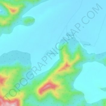
Name: Peeploon topographic map, elevation, terrain.
Location: Peeploon, Siwana Tehsil, Balotra District, Rajasthan, India (25.57337 72.36501 25.61337 72.40501)
Average elevation: 264 m
Minimum elevation: 200 m
Maximum elevation: 586 m
Thank you for supporting this site ❤️
Make a donation
Make a donation
Gear up for your next adventure:
As an Amazon Associate, this site earns from qualifying purchases at no extra cost to you.