
La Grande Métairie topographic map
Interactive map
Click on the map to display elevation.
About this map
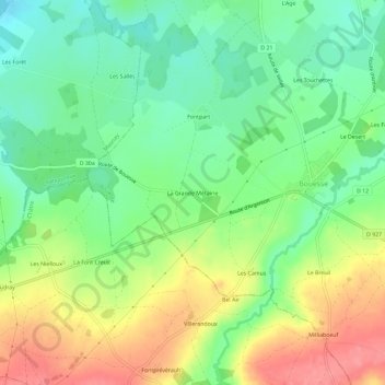
Name: La Grande Métairie topographic map, elevation, terrain.
Average elevation: 190 m
Minimum elevation: 155 m
Maximum elevation: 239 m
Other topographic maps
Click on a map to view its topography, its elevation and its terrain.
Le Desert
France > Centre-Val de Loire > Indre > Bouesse
Le Desert, Bouesse, Châteauroux, Indre, Centre-Val de Loire, France métropolitaine, 36200, France
Average elevation: 187 m