Geolocate

Klines Mill topographic map

Click on the map to display elevation.

About this map

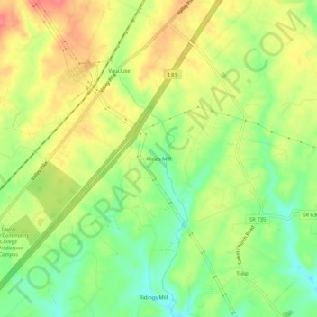
Name: Klines Mill topographic map, elevation, terrain.

Location: Klines Mill, Frederick County, Virginia, 22645, United States (39.02705 -78.26056 39.06705 -78.22056)

Average elevation: 217 m

Minimum elevation: 183 m

Maximum elevation: 251 m

Other topographic maps

Click on a map to view its topography, its elevation and its terrain.

Middletown

United States > Virginia > Frederick County

Average elevation: 211 m

Gear up for your next adventure:

🥘Camping Cookware Set - Compact nesting pots and pans for trail cooking
🏃Hydration Running Vest - Carry water and maps close to your body for speed
❄️Traction Ice Cleats - Slip-on spikes for icy trails and winter hiking
🕯️Camping Lantern - Illuminates your entire campsite with high-efficiency LEDs
🧦Crew Hiking Socks - Comfortable socks for long-distance hikes

As an Amazon Associate, this site earns from qualifying purchases at no extra cost to you.