Geolocate

Lanatan topographic map

Click on the map to display elevation.

About this map

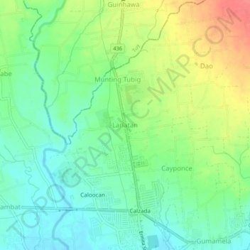
Name: Lanatan topographic map, elevation, terrain.

Location: Lanatan, Balayan, Batangas, Calabarzon, 4213, Philippines (13.94367 120.70716 13.98367 120.74716)

Average elevation: 33 m

Minimum elevation: 9 m

Maximum elevation: 72 m

Other topographic maps

Click on a map to view its topography, its elevation and its terrain.

Gear up for your next adventure:

🌡️Emergency Mylar Blankets - Compact thermal protection for unexpected nights outdoors
💧Reusable Water Bottle - Durable water bottles for hydration on trails
Family Camping Tent - Spacious tent suitable for family camping trips
🎒Fully Waterproof Backpack - Total protection for photography gear and electronics
💧Hydration Bladder - Hands-free hydration solution for long treks

As an Amazon Associate, this site earns from qualifying purchases at no extra cost to you.