Geolocate

Lossy topographic map

Click on the map to display elevation.

About this map

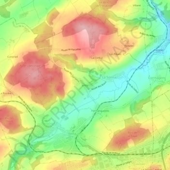
Name: Lossy topographic map, elevation, terrain.

Location: Lossy, La Sonnaz, District de la Sarine, Fribourg, 1782, Suisse (46.81306 7.09075 46.85306 7.13075)

Average elevation: 621 m

Minimum elevation: 537 m

Maximum elevation: 704 m

Gear up for your next adventure:

🥾Waterproof Hiking Shoes - Durable shoes for wet and rugged trails
🧦Thermal Socks - Warm socks for winter hiking or camping
🔦LED Headlamp - Hands-free lighting for early morning starts or late finishes
🧭GPS Outdoor Watch - Smart watch for navigation and fitness tracking in nature
🥾Trail Running Shoes - Lightweight and durable shoes for trail running

As an Amazon Associate, this site earns from qualifying purchases at no extra cost to you.