
Thank you for supporting this site ❤️
Make a donation
Make a donation
Gear up for your next adventure:
As an Amazon Associate, this site earns from qualifying purchases at no extra cost to you.
Quistococha topographic map
Click on the map to display elevation.
Thank you for supporting this site ❤️
Make a donation
Make a donation
Gear up for your next adventure:
As an Amazon Associate, this site earns from qualifying purchases at no extra cost to you.
About this map
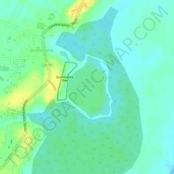
Name: Quistococha topographic map, elevation, terrain.
Location: Quistococha, San Juan Bautista, Maynas, Loreto, Perú (-3.83386 -73.32180 -3.82402 -73.31514)
Average elevation: 94 m
Minimum elevation: 84 m
Maximum elevation: 111 m
Thank you for supporting this site ❤️
Make a donation
Make a donation
Gear up for your next adventure:
As an Amazon Associate, this site earns from qualifying purchases at no extra cost to you.