
Glocester topographic map
Interactive map
Click on the map to display elevation.
About this map
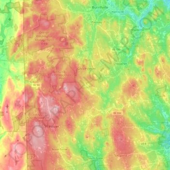
Name: Glocester topographic map, elevation, terrain.
Location: Glocester, Providence, Rhode Island, USA (41.85403 -71.79764 41.93440 -71.57511)
Average elevation: 166 m
Minimum elevation: 79 m
Maximum elevation: 247 m