
outes topographic map
Interactive map
Click on the map to display elevation.
About this map
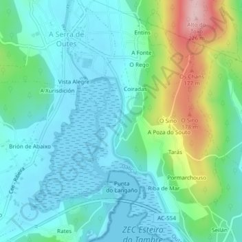
Name: outes topographic map, elevation, terrain.
Location: outes, AC-550, Outes, A Coruña, Galicië, 15230, Spanje (42.83345 -8.89991 42.83355 -8.89981)
Average elevation: 52 m
Minimum elevation: -5 m
Maximum elevation: 220 m