Geolocate

San Pedro de la Ribera topographic map

Click on the map to display elevation.

About this map

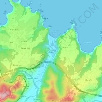
Name: San Pedro de la Ribera topographic map, elevation, terrain.

Location: San Pedro de la Ribera, Cudillero, Asturias, 33156, España (43.55282 -6.24113 43.59282 -6.20113)

Average elevation: 70 m

Minimum elevation: 0 m

Maximum elevation: 240 m

Other topographic maps

Click on a map to view its topography, its elevation and its terrain.

Concha de Artedo

España > Asturias > Cudillero > El Rellayo

Average elevation: 68 m

Gear up for your next adventure:

🧴Bear Spray Holster - Quick-access carry for essential Canadian wilderness safety
🧥Ultralight Puffy Jacket - Maximum warmth that packs down to the size of an orange
🚲Bike Repair Kit - Essential tools for on-trail mechanical issues
🎒Fully Waterproof Backpack - Total protection for photography gear and electronics
❄️Traction Ice Cleats - Slip-on spikes for icy trails and winter hiking

As an Amazon Associate, this site earns from qualifying purchases at no extra cost to you.