
Bretagne topographic map
Interactive map
Click on the map to display elevation.
About this map
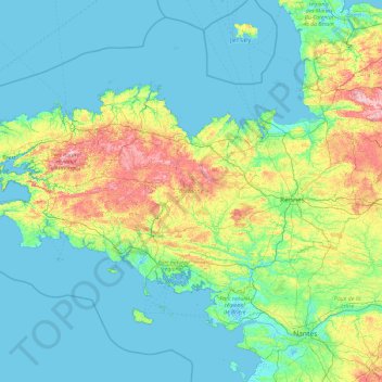
Name: Bretagne topographic map, elevation, terrain.
Location: Bretagne, França metropolitana, França (47.44125 -4.79551 48.88447 -1.01569)
Average elevation: 50 m
Minimum elevation: -3 m
Maximum elevation: 371 m