Geolocate

Wambach topographic map

Click on the map to display elevation.

About this map

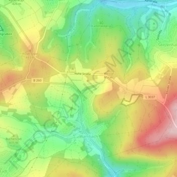
Name: Wambach topographic map, elevation, terrain.

Location: Wambach, Schlangenbad, Rheingau-Taunus-Kreis, Hesse, Germany (50.10122 8.08576 50.13285 8.12125)

Average elevation: 425 m

Minimum elevation: 308 m

Maximum elevation: 568 m

Gear up for your next adventure:

🥤Collapsible Travel Cup - Saves space and weight in your mess kit
🥘Camping Cookware Set - Compact nesting pots and pans for trail cooking
🛁Quick-Dry Microfiber Towel - Space-saving towel that dries rapidly on the move
🛌Insulated Sleeping Pad - Critical thermal barrier between you and the cold ground
🧥Ultralight Puffy Jacket - Maximum warmth that packs down to the size of an orange

As an Amazon Associate, this site earns from qualifying purchases at no extra cost to you.