Geolocate

San Isidro topographic map

Click on the map to display elevation.

About this map

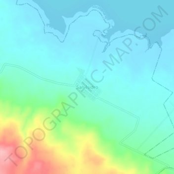
Name: San Isidro topographic map, elevation, terrain.

Location: San Isidro, La Concordia, Chiapas, Mexico (15.95903 -92.36618 15.99903 -92.32618)

Average elevation: 552 m

Minimum elevation: 521 m

Maximum elevation: 657 m

Gear up for your next adventure:

🧥Waterproof Pants - Keep dry during rainy hiking conditions
🥾Trail Hiking Socks - Comfortable socks to prevent blisters and fatigue
🚑Survival Whistle - Signal for help across long distances in mountains
🧴Outdoor Sunscreen - High SPF protection for high-altitude UV exposure
🔦LED Flashlight - Powerful and long-lasting flashlight for camping and emergencies

As an Amazon Associate, this site earns from qualifying purchases at no extra cost to you.