
Sawback topographic map
Interactive map
Click on the map to display elevation.
About this map
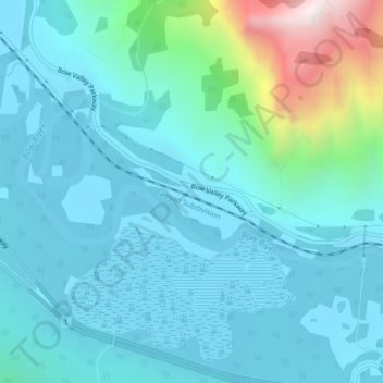
Name: Sawback topographic map, elevation, terrain.
Location: Sawback, Improvement District No. 9, Alberta, Canada (51.16159 -115.71581 51.18159 -115.69581)
Average elevation: 1,537 m
Minimum elevation: 1,383 m
Maximum elevation: 2,356 m
Other topographic maps
Click on a map to view its topography, its elevation and its terrain.
Saskatchewan River Crossing
Canada > Alberta > Improvement District No. 9
Saskatchewan River Crossing, Improvement District No. 9, Alberta, Canada
Average elevation: 1,443 m