Geolocate

Sand Run topographic map

Click on the map to display elevation.

About this map

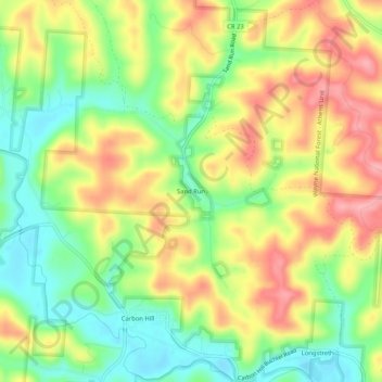
Name: Sand Run topographic map, elevation, terrain.

Location: Sand Run, Hocking County, Ohio, 43247, United States (39.49507 -82.25737 39.53507 -82.21737)

Average elevation: 257 m

Minimum elevation: 203 m

Maximum elevation: 314 m

Other topographic maps

Click on a map to view its topography, its elevation and its terrain.

Murray City

United States > Ohio > Hocking County

Average elevation: 257 m

Rose Lake

United States > Ohio > Hocking County

Average elevation: 295 m

Logan

United States > Ohio > Hocking County

Average elevation: 254 m

Rose Lake Dam

United States > Ohio > Hocking County

Average elevation: 297 m

Gear up for your next adventure:

🥾Approach Shoes - Shoes designed for climbing approaches and rugged trails
🧰Survival Kit - Essential gear for emergencies in the wilderness
🥾Trail Running Boots - Durable shoes designed for trail running
🧊Portable Cooler - Keep food and drinks cold during outdoor adventures
Lightweight Backpacking Tent - Compact tent for efficient hiking trips

As an Amazon Associate, this site earns from qualifying purchases at no extra cost to you.