Geolocate

Midway topographic map

Click on the map to display elevation.

About this map

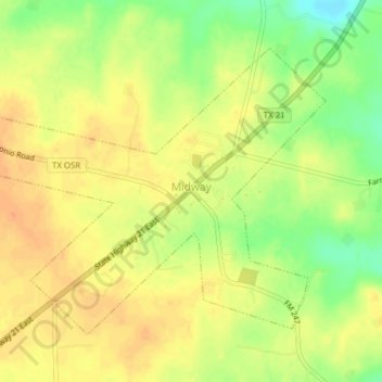
Name: Midway topographic map, elevation, terrain.

Location: Midway, Madison County, Texas, United States (31.01315 -95.77557 31.03804 -95.73688)

Average elevation: 76 m

Minimum elevation: 52 m

Maximum elevation: 89 m

Gear up for your next adventure:

🦶Anti-Blister Balm - Prevents friction and hotspots during long ascents
💧Reusable Water Bottle - Durable water bottles for hydration on trails
🥾Hiking Leggings - Comfortable leggings for outdoor activities
💡Solar Camping Lamp - Eco-friendly lighting for campsites
💧Hydration Pack - Hands-free hydration system for long hikes

As an Amazon Associate, this site earns from qualifying purchases at no extra cost to you.