Geolocate

La Concha topographic map

Click on the map to display elevation.

About this map

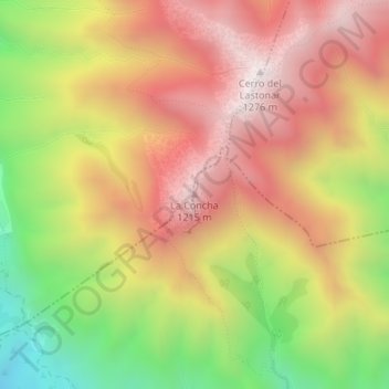
Name: La Concha topographic map, elevation, terrain.

Location: La Concha, Marbella, Costa del Sol Occidental, Malaga, Andalusia, 29611, Spain (36.55159 -4.92503 36.55169 -4.92493)

Average elevation: 784 m

Minimum elevation: 192 m

Maximum elevation: 1,254 m

Other topographic maps

Click on a map to view its topography, its elevation and its terrain.

Gear up for your next adventure:

🕶️Polarized Sunglasses - Protect your eyes with durable polarized lenses
🎒Hiking Backpack - Lightweight and ergonomic backpacks for day hikes or multi-day treks
Lightweight Backpacking Tent - Compact tent for efficient hiking trips
🛶Kayak Accessories - Essential gear for safe and fun kayaking adventures
🧭GPS Outdoor Watch - Smart watch for navigation and fitness tracking in nature

As an Amazon Associate, this site earns from qualifying purchases at no extra cost to you.