
Thank you for supporting this site ❤️
Make a donation
Make a donation
Gear up for your next adventure:
As an Amazon Associate, this site earns from qualifying purchases at no extra cost to you.
Le Goillaz-Dessus topographic map
Click on the map to display elevation.
Thank you for supporting this site ❤️
Make a donation
Make a donation
Gear up for your next adventure:
As an Amazon Associate, this site earns from qualifying purchases at no extra cost to you.
About this map
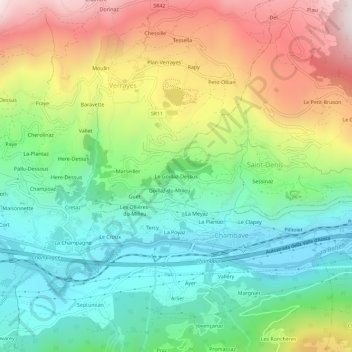
Name: Le Goillaz-Dessus topographic map, elevation, terrain.
Location: Le Goillaz-Dessus, Saint-Denis, Valle d'Aosta, 11023, Italia (45.73121 7.52084 45.77121 7.56084)
Average elevation: 824 m
Minimum elevation: 459 m
Maximum elevation: 1,431 m
Thank you for supporting this site ❤️
Make a donation
Make a donation
Gear up for your next adventure:
As an Amazon Associate, this site earns from qualifying purchases at no extra cost to you.