Geolocate

Ruatoki North topographic map

Click on the map to display elevation.

About this map

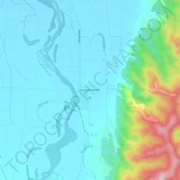
Name: Ruatoki North topographic map, elevation, terrain.

Location: Ruatoki North, Whakatāne District, Bay of Plenty, New Zealand (-38.15761 176.98670 -38.11761 177.02670)

Average elevation: 75 m

Minimum elevation: 20 m

Maximum elevation: 314 m

Other topographic maps

Click on a map to view its topography, its elevation and its terrain.

Gear up for your next adventure:

🧰Survival Kit - Essential gear for emergencies in the wilderness
👟Leg Gaiters - Keep debris, mud, and snow out of your boots
🥾Trail Running Boots - Durable shoes designed for trail running
💡LED Camping Lantern - Illuminate your campsite with long-lasting lanterns
🧤Insulated Winter Gloves - Heavy-duty protection for sub-zero Canadian adventures

As an Amazon Associate, this site earns from qualifying purchases at no extra cost to you.