Geolocate

Yuhu topographic map

Click on the map to display elevation.

About this map

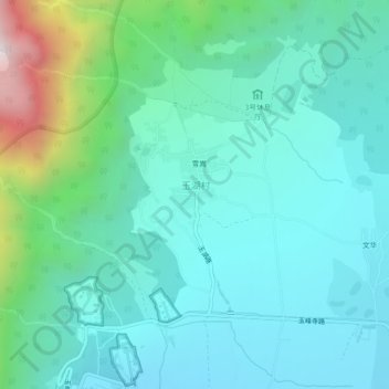
Name: Yuhu topographic map, elevation, terrain.

Location: Yuhu, Yulong Nakhi Autonomous County, Lijiang City, Yunnan, 674101, China (26.99353 100.19247 27.03353 100.23247)

Average elevation: 2,828 m

Minimum elevation: 2,584 m

Maximum elevation: 3,828 m

Other topographic maps

Click on a map to view its topography, its elevation and its terrain.

Yunshanping

China > Yunnan > Yulong Nakhi Autonomous County > Daju

Average elevation: 3,183 m

Gear up for your next adventure:

🧴Insect Repellent - Protect yourself from bugs during outdoor adventures
🧴Bear Spray Holster - Quick-access carry for essential Canadian wilderness safety
🥾Mountaineering Boots - Supportive boots for climbing and high-altitude hiking
🥾Trail Hiking Socks - Comfortable socks to prevent blisters and fatigue
🪑Ultralight Camping Stool - Compact seating for rest stops during long hikes

As an Amazon Associate, this site earns from qualifying purchases at no extra cost to you.