Geolocate

Nuoro topographic map

Click on the map to display elevation.

About this map

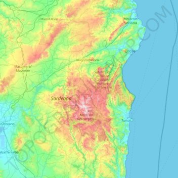
Name: Nuoro topographic map, elevation, terrain.

Location: Nuoro, Sardinia, Italy (39.82221 8.61116 40.70600 9.82932)

Average elevation: 456 m

Minimum elevation: -2 m

Maximum elevation: 1,821 m

Gear up for your next adventure:

🧢Sun Hat - Wide-brim hat for sun protection
🚲Handlebar Phone Mount - View topographic-map.com live while cycling
🔭Compact Monocular - One-handed bird watching and trail spotting
🧢Hiking Hat - Sun-protective and breathable hats for long treks
🥾Mountain Trail Shoes - High-traction shoes for mountain trails

As an Amazon Associate, this site earns from qualifying purchases at no extra cost to you.