Geolocate

Praglie topographic map

Click on the map to display elevation.

About this map

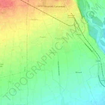
Name: Praglie topographic map, elevation, terrain.

Location: Praglie, Rivarolo Canavese, Torino, Piemont, 10086, Italy (45.29360 7.69603 45.33360 7.73603)

Average elevation: 290 m

Minimum elevation: 264 m

Maximum elevation: 325 m

Gear up for your next adventure:

🧥Insulated Jacket - Keep warm in cold outdoor conditions
💡LED Camping Lantern - Illuminate your campsite with long-lasting lanterns
🔦LED Headlamp - Hands-free lighting for early morning starts or late finishes
🥾Lightweight Hiking Shoes - Comfortable shoes for day hikes
🔥Emergency Fire Starter - Reliable ignition source for all weather conditions

As an Amazon Associate, this site earns from qualifying purchases at no extra cost to you.