
Thank you for supporting this site ❤️
Make a donation
Make a donation
Gear up for your next adventure:
As an Amazon Associate, this site earns from qualifying purchases at no extra cost to you.
Anchoto topographic map
Click on the map to display elevation.
Thank you for supporting this site ❤️
Make a donation
Make a donation
Gear up for your next adventure:
As an Amazon Associate, this site earns from qualifying purchases at no extra cost to you.
About this map
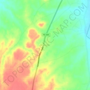
Name: Anchoto topographic map, elevation, terrain.
Location: Anchoto, Ilave, El Collao, Puno, Perú (-16.23733 -69.69435 -16.19733 -69.65435)
Average elevation: 3,877 m
Minimum elevation: 3,849 m
Maximum elevation: 3,908 m
Thank you for supporting this site ❤️
Make a donation
Make a donation
Gear up for your next adventure:
As an Amazon Associate, this site earns from qualifying purchases at no extra cost to you.