Geolocate

Pilot Knob topographic map

Click on the map to display elevation.

About this map

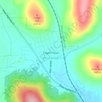
Name: Pilot Knob topographic map, elevation, terrain.

Location: Pilot Knob, Iron County, Missouri, 63663, United States (37.61291 -90.65898 37.63307 -90.63130)

Average elevation: 334 m

Minimum elevation: 276 m

Maximum elevation: 469 m

Other topographic maps

Click on a map to view its topography, its elevation and its terrain.

Belleview

United States > Missouri > Iron County

Average elevation: 328 m

Russellville

United States > Missouri > Iron County > Arcadia

Average elevation: 299 m

Gear up for your next adventure:

🕯️Camping Lantern - Illuminates your entire campsite with high-efficiency LEDs
🧴Waterproofing Spray - Restore the DWR coating on jackets and tents
🧭GPS Handheld Device - Reliable GPS navigation for outdoor adventures
🥾Durable Hiking Shoes - Long-lasting shoes for frequent hiking
🛶Kayak Accessories - Essential gear for safe and fun kayaking adventures

As an Amazon Associate, this site earns from qualifying purchases at no extra cost to you.