Geolocate

Piuca topographic map

Click on the map to display elevation.

About this map

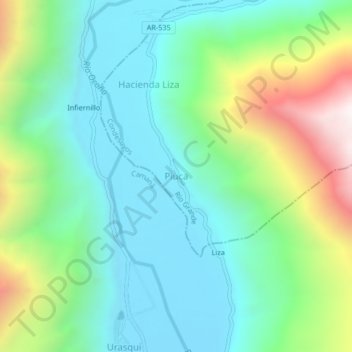
Name: Piuca topographic map, elevation, terrain.

Location: Piuca, Río Grande, Condesuyos, Arequipa, Perú (-16.03089 -73.18750 -15.99089 -73.14750)

Average elevation: 722 m

Minimum elevation: 344 m

Maximum elevation: 1,675 m

Other topographic maps

Click on a map to view its topography, its elevation and its terrain.

Río Grande

Perú > Arequipa > Río Grande

Average elevation: 1,775 m

Gear up for your next adventure:

🧴Sunscreen SPF - Broad-spectrum sunscreen for outdoor activities
🧭GPS Tracker - Track your location in remote areas safely
🛶Canoe Life Vest - Safety vest for water sports
🎒Hiking Backpack - Lightweight and ergonomic backpacks for day hikes or multi-day treks
🥾Waterproof Hiking Boots - Essential footwear for rugged terrain and wet Canadian trails

As an Amazon Associate, this site earns from qualifying purchases at no extra cost to you.