Geolocate

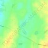
Pine Point topographic map

Click on the map to display elevation.

About this map

Name: Pine Point topographic map, elevation, terrain.

Location: Pine Point, Yorke Peninsula Council, South Australia, 5571, Australia (-34.62760 137.83636 -34.53066 137.89158)

Average elevation: 30 m

Minimum elevation: 0 m

Maximum elevation: 92 m

Other topographic maps

Click on a map to view its topography, its elevation and its terrain.
Gear up for your next adventure:

⛺Bushcraft Tarp - Versatile emergency shelter or gear protection
🔥Emergency Fire Starter - Reliable ignition source for all weather conditions
🧼Travel Hand Sanitizer - Keep hands clean when water is scarce
⛺Backpacking Tent - Lightweight tent for long-distance hiking trips
🥾Lightweight Hiking Shoes - Comfortable shoes for day hikes

As an Amazon Associate, this site earns from qualifying purchases at no extra cost to you.