Make a donation
Gear up for your next adventure:
As an Amazon Associate, this site earns from qualifying purchases at no extra cost to you.
Löhrieth topographic map
Click on the map to display elevation.
Make a donation
Gear up for your next adventure:
As an Amazon Associate, this site earns from qualifying purchases at no extra cost to you.
Löhrieth
Die etwa 300 Jahre alte Dorflinde, eine Winterlinde, hat einen Umfang von 5,30 Meter, sie hat eine Höhe von 18 m erreicht (siehe Liste der Naturdenkmäler im Landkreis Rhön-Grabfeld).
Make a donation
Gear up for your next adventure:
As an Amazon Associate, this site earns from qualifying purchases at no extra cost to you.
About this map
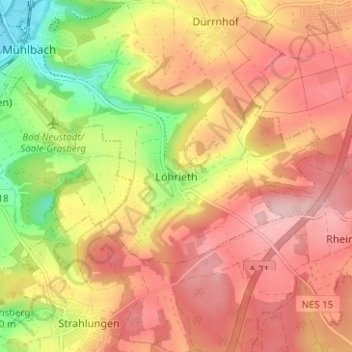
Name: Löhrieth topographic map, elevation, terrain.
Average elevation: 333 m
Minimum elevation: 227 m
Maximum elevation: 404 m
Make a donation
Gear up for your next adventure:
As an Amazon Associate, this site earns from qualifying purchases at no extra cost to you.
