Geolocate

Vaughn topographic map

Click on the map to display elevation.

About this map

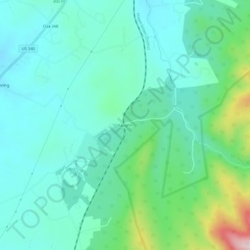
Name: Vaughn topographic map, elevation, terrain.

Location: Vaughn, Page County, Virginia, 22650, United States (38.69873 -78.41751 38.73873 -78.37751)

Average elevation: 304 m

Minimum elevation: 223 m

Maximum elevation: 596 m

Gear up for your next adventure:

🔭Compact Monocular - One-handed bird watching and trail spotting
🧰Emergency Multi-Tool - Compact multi-tool for outdoor survival
🧊Portable Cooler - Keep food and drinks cold during outdoor adventures
🕶️Polarized Sunglasses - Protect your eyes with durable polarized lenses
🧤Thermal Hiking Gloves - Grip-enhanced gloves for cold-weather altitude trekking

As an Amazon Associate, this site earns from qualifying purchases at no extra cost to you.