
Thank you for supporting this site ❤️
Make a donation
Make a donation
Gear up for your next adventure:
As an Amazon Associate, this site earns from qualifying purchases at no extra cost to you.
Ijebu-Igbo topographic map
Click on the map to display elevation.
Thank you for supporting this site ❤️
Make a donation
Make a donation
Gear up for your next adventure:
As an Amazon Associate, this site earns from qualifying purchases at no extra cost to you.
About this map
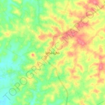
Name: Ijebu-Igbo topographic map, elevation, terrain.
Location: Ijebu-Igbo, Ijebu North, Ogun State, Nigeria (6.93031 3.96053 7.01031 4.04053)
Average elevation: 87 m
Minimum elevation: 53 m
Maximum elevation: 124 m
Thank you for supporting this site ❤️
Make a donation
Make a donation
Gear up for your next adventure:
As an Amazon Associate, this site earns from qualifying purchases at no extra cost to you.