Geolocate

Watseka topographic map

Click on the map to display elevation.

About this map

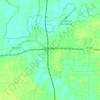
Name: Watseka topographic map, elevation, terrain.

Location: Watseka, Iroquois County, Illinois, 60970, United States (40.75984 -87.76509 40.79047 -87.69579)

Average elevation: 194 m

Minimum elevation: 188 m

Maximum elevation: 200 m

Gear up for your next adventure:

🥾Waterproof Hiking Boots - Boots keeping your feet dry in wet conditions
💧Filtered Water Bottle - Safe drinking water on the go
🧥Packable Rain Jacket - Breathable waterproof layer for unpredictable weather
🕯️Camping Lantern - Illuminates your entire campsite with high-efficiency LEDs
🛏️Sleeping Bag - Warm and compact sleeping bags for outdoor camping

As an Amazon Associate, this site earns from qualifying purchases at no extra cost to you.