Geolocate

Dalaman topographic map

Click on the map to display elevation.

About this map

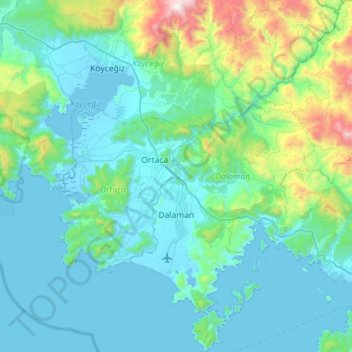
Name: Dalaman topographic map, elevation, terrain.

Location: Dalaman, Muğla, Aegean Region, 48770, Turkey (36.58860 28.72586 37.03628 29.19389)

Average elevation: 349 m

Minimum elevation: -9 m

Maximum elevation: 2,113 m

Gear up for your next adventure:

🧦Outdoor Socks - Durable socks designed for hiking and outdoor sports
Camping Tent - Weather-resistant tents suitable for 2 to 6 people
🥾Trekking Poles - Adjustable trekking poles to reduce knee stress and improve stability
🔦UV Flashlight - Detect minerals or specific insects in the dark
🥾Light Trekking Boots - Supportive boots for multi-day treks

As an Amazon Associate, this site earns from qualifying purchases at no extra cost to you.