Geolocate

Bagonbon topographic map

Click on the map to display elevation.

About this map

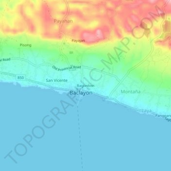
Name: Bagonbon topographic map, elevation, terrain.

Location: Bagonbon, Baclayon, Bohol, Central Visayas, 6301, Philippines (9.60382 123.89426 9.64382 123.93426)

Average elevation: 39 m

Minimum elevation: -1 m

Maximum elevation: 150 m

Gear up for your next adventure:

🥘Camping Cookware Set - Compact nesting pots and pans for trail cooking
💧Reusable Water Bottle - Durable water bottles for hydration on trails
🎒Fully Waterproof Backpack - Total protection for photography gear and electronics
🧰Survival Kit - Essential gear for emergencies in the wilderness
🎒Hiking Backpack - Lightweight and ergonomic backpacks for day hikes or multi-day treks

As an Amazon Associate, this site earns from qualifying purchases at no extra cost to you.