
Tamantirto topographic map
Click on the map to display elevation.
About this map
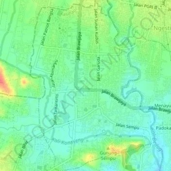
Name: Tamantirto topographic map, elevation, terrain.
Average elevation: 87 m
Minimum elevation: 69 m
Maximum elevation: 124 m
Other topographic maps
Click on a map to view its topography, its elevation and its terrain.
Gerojogan Lepo
Indonesia > Special Region of Yogyakarta > Bantul Regency > Dlingo
Average elevation: 133 m
Depok Beach
Indonesia > Special Region of Yogyakarta > Bantul Regency > Parangtritis
Average elevation: 3 m