Geolocate

Taita topographic map

Click on the map to display elevation.

About this map

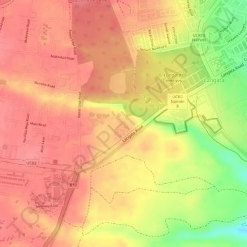
Name: Taita topographic map, elevation, terrain.

Location: Taita, Langata, Nairobi, Kenya (-1.33784 36.77160 -1.33750 36.77198)

Average elevation: 1,780 m

Minimum elevation: 1,720 m

Maximum elevation: 1,802 m

Gear up for your next adventure:

Backpacking Tent - Lightweight tent for long-distance hiking trips
🧥Waterproof Jacket - Lightweight rain jackets for hiking and outdoor activities
Family Camping Tent - Spacious tent suitable for family camping trips
🧥Fleece Jacket - Warm and lightweight jacket for layering
🗺️Topographic Maps - Detailed maps to explore trails, mountains, and wilderness areas

As an Amazon Associate, this site earns from qualifying purchases at no extra cost to you.