
Eastanollee topographic map
Click on the map to display elevation.
About this map
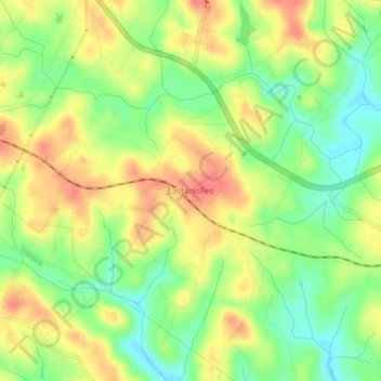
Name: Eastanollee topographic map, elevation, terrain.
Location: Eastanollee, Stephens County, Georgia, 30538, United States (34.50027 -83.27549 34.54027 -83.23549)
Average elevation: 266 m
Minimum elevation: 231 m
Maximum elevation: 302 m
Other topographic maps
Click on a map to view its topography, its elevation and its terrain.
Toccoa
United States > Georgia > Stephens County
Altitude is 313 m (1,027 ft).
Average elevation: 303 m
Toccoa
United States > Georgia > Stephens County
Altitude is 313 m (1,027 ft).
Average elevation: 303 m
Toccoa
United States > Georgia > Stephens County
Altitude is 313 m (1,027 ft).
Average elevation: 303 m
Toccoa
United States > Georgia > Stephens County
Altitude is 313 m (1,027 ft).
Average elevation: 303 m