
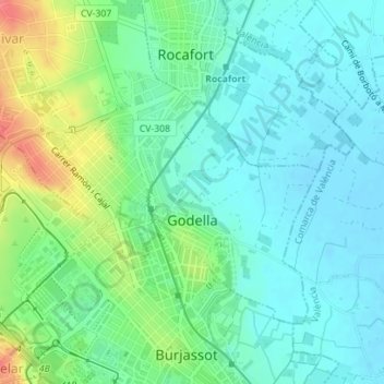
Godella topographic map
Interactive map
Click on the map to display elevation.
About this map
Name: Godella topographic map, elevation, terrain.
Location: Godella, Huerta Norte, Valencia, Comunidad Valenciana, España (39.51481 -0.42669 39.52601 -0.40694)
Average elevation: 37 m
Minimum elevation: 19 m
Maximum elevation: 81 m
Other topographic maps
Click on a map to view its topography, its elevation and its terrain.
Campo Olivar
España > Comunidad Valenciana > Godella
Campo Olivar, Campolivar, Godella, Huerta Norte, Valencia, Comunidad Valenciana, 46980, España
Average elevation: 88 m